|
Mount Fitz Roy (Cerro Chaltén or Cerro Fitz Roy) is the main mountain located near El Chaltén village, in Santa Cruz province of Argentina and is part of the southern Patagonian Ice Field. It generates a lot of weather, being the highest peak in the area!
It is 'only' 3,359 metre high, I have been on peaks over 4000m high, but I won't be climbing it as it is technically very difficult due to the long granite faces, and my best mountaineering days are well in the past!
In the few days I had in El Chaltén, it was not totally clear one time. The best photos I took were from the steppe outside El Chaltén, you can't really see it well from the town. I waited about 4 hours and took photos whenever the weather threatened to clear. El Chaltén calls itself the hiking capital of Patagonia, but it should also call itself the slowest internet capital in Argentina, that is when it actually works.
As Mount Fitz Roy appeared and disappeared in the clouds, it still made a very impressive sight. I just wish I had been able to do the three lakes (Laguna de los Tres) walk nearer to the glaciers at its base. I only managed two short hikes as the weather turned against me, even though it was high summer season in December! The walk to Laguna Capri started in sunshine but halfway to the lagoon the wind brought sleet and snow and when I reached the lake there was no view of the mountain. My other short walk was to Chorillo di Salto, a waterfall of about 70m height.
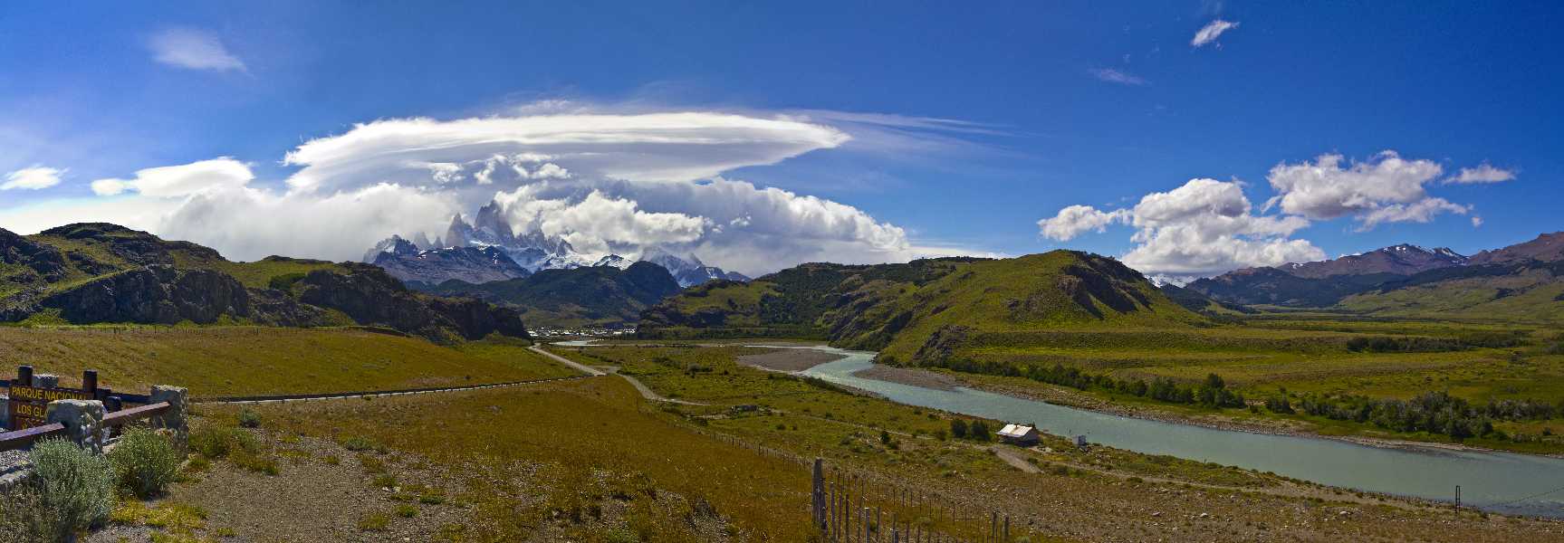
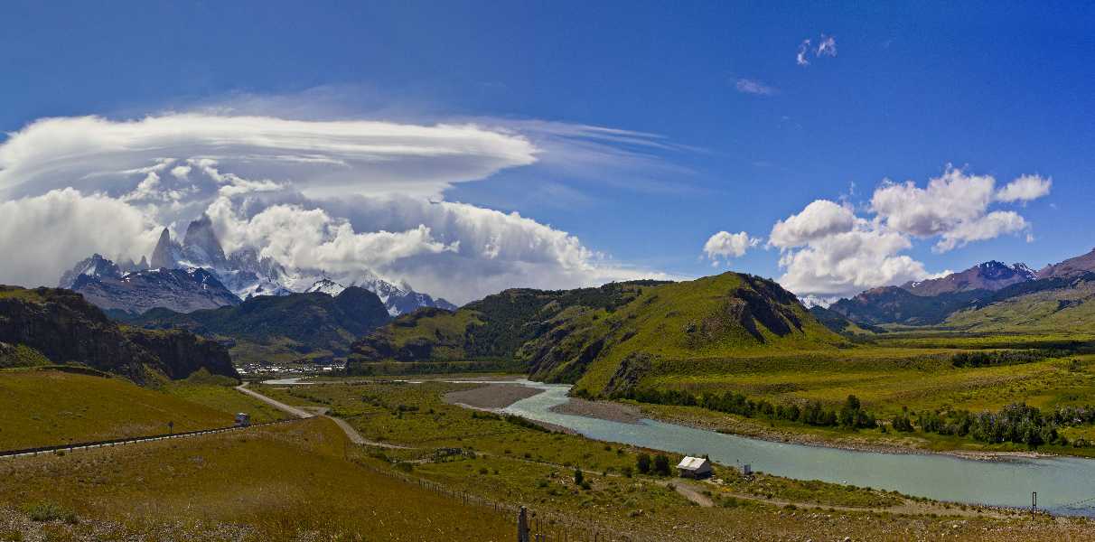
The photos were taken on the steppe, several kilometres outside El Chaltén, about a kilometre before the turnoff to Bahia tunnel. The first photo is of Cerro Torre, a peak to the north of Cerro Fitz Roy and slightly to the west. The other photos are on Cerro Fitzroy (Mount Fitz Roy) itself. The weather was constantly changing with cloud obscuring at least a part of the mountain, sometimes most of it. The clouds were bringing snow at the higher elevations, as is clear in the first photo.
The panoramas were taken about a kilometre outside El Chaltén at a lookout point, just before you drop down to the river valley floor where El Chaltén is situated.
My first night in El Chaltén, the wind changed to the west and turned very stormy, the guests in our hosteria were 'entertained' by the sound of wind gusts trying to take the roof off the building. And that is with the town lying in a relatively sheltered valley!
The first couple of photos were taken just outside El Chaltén. The next three in the town itself, including the restored 1960s Automobile Fiat.
The next four photos are on the Laguna Capri walk of the Rio de las Vueltas. The next photo is a Magellanic woodpecker, I would assume a male from his red coloring. The next was the view of Mount Fitz Roy (!) from Laguna Capri, where it was very windy with snow and sleet, and then one on the return walk from Laguna Capri. By the way, the guide book list the walk as 1 3/4 to 2 hours each way, but it took me 1 hour up and 45 minutes return, so I would take the walking times as very conservative for all treks there.
The following photos were taken on the very easy Chorillo di Salto waterfall walk.
Upon my return I stopped at my favourite pub in El Chaltén for beer and dinner. In the Cerveceria Don Guerra, I ran into 6 young '20 something' Americans who had also been on the Viedmar glacier Ice Trek and they welcomed me to join them for dinner. The bar tender was amazed to see an oldie like me sitting with these 6 young women and asked if I was their teacher ;-). We had a bit of fun with him. Sorry, they didn't send the group photo they promised.
| 
 Copyright LC Consulting, LC Publishing © 2005 - 2020